Picture #17
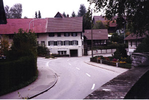
Picture #17 - Steinmaur's main street, charming and definitely off the tourist path. Neerach, Obersteinmaur, Steinmaur, and Niedersteinmaur run together from north to south. Four generations (Hans, Jacob, Old Henry, Young Henry) of Surbers lived here.
Pictures #18
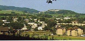
Pictures #18 - Dielsdorf, the largest town in the area, almost at the bottom of the hill on the east side of Regensberg. Traveler's tip - Stop here at Fleischli bakery and cafeteria for wonderful sandwiches, fresh salads, and fabulous pastries. Dielsdorf has the only bookstore in the area. Pick up the Baden 1:50,000 topo map for all the towns of Surber history.
Picture #19
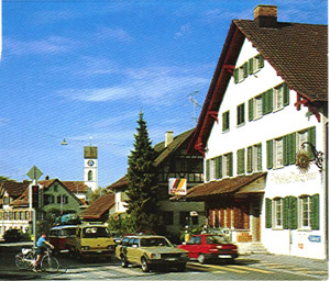
Picture #19 - Typical Dielsdorf street.
Picture #20
Picture #20 - Town of Niederweningen. The Surb River runs through it. The river parallels the highway that comes in from the right at the 3 o'clock position and runs past the large building toward the upper left corner of the picture. The old part of town is on the left, the place where Michael Surber (1582-bef.1643) and Hans Surber (1624-1679) were born.
Picture #21
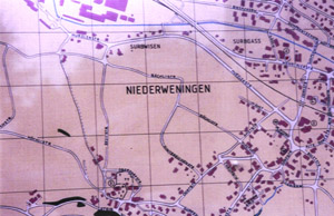
Picture #21 - Note "Surbwisen" or Surb Meadow near the top center. Note "Surbgass" or Surb Alley near the top right. These illustrate how common the names Surb and Surber are in this area. In Oberweningen alone, there are 12 Surber families listed in the phone book. The blue stripe is the Surb River.
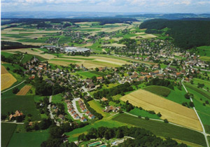
Pictures #22
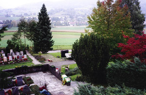
Pictures #22 - Niederweningen seen from the church cemetery, whose steeple you can see in the left center of picture #20. This looks northeast across the area called Surbwisen.
Pictures #23
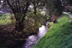
Pictures #23 - In Oberweningen and Niederweningen, northwest of Regensberg, the Surb River looks like a meandering creek. You could jump across it.
Pictures #24

Pictures #24 - As it flows northwest, it widens until it joins the Aare River at the city of Klingnau (Carol Lewis showed a picture of this.) and then runs north into the Rhine. Our ancestors sailed up the Rhine here to Rotterdam and from there traveled to the New World.
End notes -
A. The Hedinger book pg. 104,105 published a copy of a census,
probably 1753-1758. It listed Schultheiss Laba (Mayor Laba) as
having a household of 1 man, 1 male over 16, 1 woman, 1 girl
under 16, 1 absent male, occupation of butcher, 10 fields, 10
open acres, 2 vineyards, 1 steer, 2 cows, 1 pig, and 2 chickens.
He had no woods, horses, sheep, goats, geese or doves. This appeared
to be the third wealthiest of 36 households. Does anyone know
how Heinrich Laba relates to a female Surber line?
B. Carol Lewis asked about a house with the Surber name on the side. It's on Wehntalerstrasse (Wehn valley street) at the west edge of Oberweningen and seems to be the office of a residential building contractor surnamed you-know-what.
C. Just three weeks before our trip to hike the mountains of the Jungfrau region, I learned about Swiss ancestors for the first time. Being new to genealogy this year, I didn't attempt to make any contacts on this trip. We just tried winging it on a cloudy, rainy day. Actually it rained and flooded the entire two weeks we were in Europe, but we had a good time anyway. Pictures 1, 9, 18, 19 and 20 with sunny skies are postcards by Photoglob Zurich/Vevey and Photoramacolor AG.
D. Special thanks to Carol Lewis for publishing this report on the web! msb